MyDraw provides support for importing of geographical map data from the popular ESRI shapefile format (".shp"). To import a map in MyDraw, click File -> Import -> Map. In the open file dialog that opens, select the shapefile to import and click Open.
If the shapefile you want to open has an accompanying data file (i.e. a file with the same name, but with a different extension - ".dbf"), the following dialog will open:
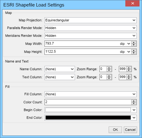
This dialog lets you configure how the data from the DBF file should be used when importing the map in MyDraw.
The Name and Text group box lets you select the columns that should provide the names and the texts of the imported shapes, as well at in what zoom range the shapes and their text should be visible.
The Fill group box lets you select a column, whose values should be used for filling. The filling is defined by the selected number of colors, begin and end color. MyDraw will automatically create color shades starting from the selected begin color and ending at the end color. This lets you easily color a map by a data column defined in the data file. For example, you can color the countries in a world map based on their population. The countries with small population - white, the ones with more population - light green, those with large population - green and the countries with most population - dark green.